Find out what makes these picture-perfect paths our favorites
Tempe is known for many things: Mill Avenue, Arizona State University and more than a few lively festivals and events. But did you know that Tempe is also widely known as a bike-friendly city?
In 2019, the League of American Bicyclists designated Tempe a Gold-Level Bicycle-Friendly Community Award winner. Tempe was recognized for safe bike paths and for promoting biking to work and for recreation.
For a 40-square-mile city, it’s amazing that there are 217 miles of Tempe bike paths, from Sonoran Desert trails to bike lanes on city streets. For details about these bike paths, videos about bike safety and more, visit the City of Tempe website: tempe.gov/bike.
If you don’t have a bike of your own, you can rent one from The Bicycle Cellar or borrow one from one of the Tempe hotels that have bikes for their guests: Canopy by Hilton Tempe Downtown, Moxy Phoenix Tempe and Graduate Tempe.
Biking is part of our way of life in Tempe, and we’ve detailed our six favorite paths for your next biking adventure:
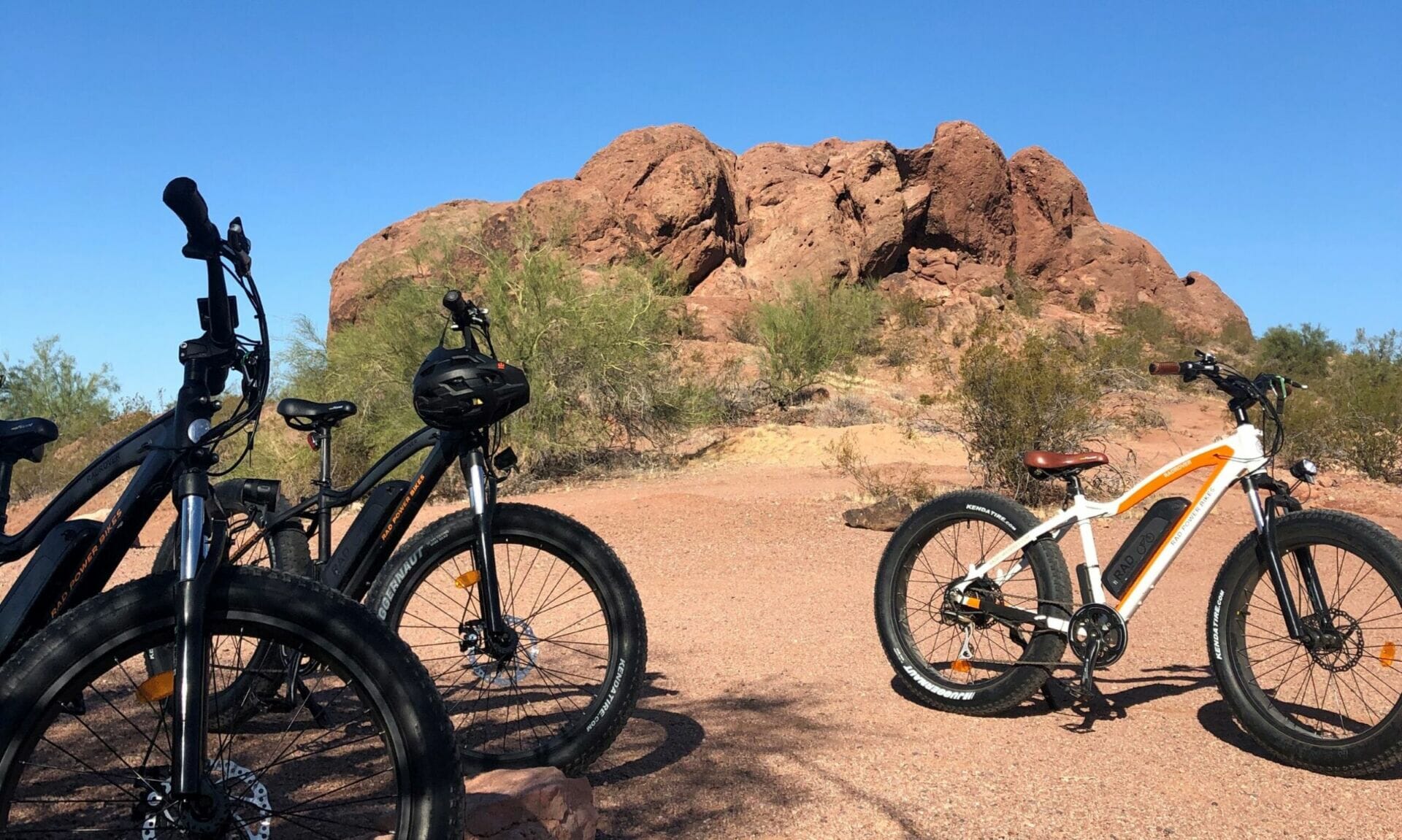
1. Crosscut Canal Path
The City of Tempe recently made improvements to the Crosscut Canal Path, which winds through Papago Park. Our favorite way to get there is to ride north on Mill Avenue, over the bridge and then just past Curry Road (on the east side of the street) to the entrance to this canal path. Once you turn on to the tree-lined canal, you’ll notice several public art installations as well as a disc golf course. Continuing up the hill, you’ll see the buttes of Papago Park (definitely worth a little more exploring), the Rolling Hills Golf Course and even a few aqueducts that connect to the canal system. For the return trip, ride along to the other side of Mill Avenue, just behind the Marquee Theatre to connect to the paths on the north shore of Tempe Town Lake. From here, you can head west and go over the lake via the Elmore Pedestrian Bridge and then cruise through Tempe Beach Park.
2. Tempe Town Lake and Tempe Beach Park
This 2.5-mile urban lake has paved paths on either bank. For a picture-perfect riding loop, just choose where you’d like to cross. The north and south shores of Tempe Town Lake are connected by the Mill Avenue bridge, the Elmore Pedestrian Bridge and the Rural Road Bridge — all of which are particularly stunning at sunrise and sunset. Paths around Tempe Town Lake are open from 5 a.m. to midnight every day. The complete loop, from south McClintock Drive to north Priest Drive, is 7.5 miles.
Tempe Town Lake is easily accessible by Valley Metro Rail, which is bike-friendly transportation. And any ride in Downtown Tempe wouldn’t be complete without a jaunt down Mill Avenue — we think it’s time to refuel with a bite to eat!
3. Rio Salado Pathway
Voted “Best Bike Path” by the Phoenix New Times, this paved path along the Salt River shore stretches 19 miles. If you’ve cycled around Tempe Town Lake, technically you’ve already experienced what’s possibly our favorite segment. But don’t stop there. Running from just south of downtown Phoenix all the way east to Mesa, this path gives riders hopping on in Tempe plenty of options. Head east and you’ll pass Tempe Marketplace off of south McClintock, head west and you’ll pass Phoenix Sky Harbor International Airport. While the scenic landscapes — both rural and urban — never disappoint, keep your eyes peeled and you might spot birds and small wildlife.
4. Indian Bend Wash Path
Indian Bend Wash Path (aka the Indian Bend Wash Greenbelt or the Scottsdale Greenbelt) follows the banks of Indian Bend Wash for nearly 20 miles: from the north side of Tempe Town Lake north to Scottsdale’s Venturoso Park. Along the way, the paved path — which is wide and mostly flat — connects a number of public parks, schools and golf courses, and features multiple bridges and tunnels to avoid major traffic crossings. From Tempe, hop on the Rio Salado Pathway, from there, you can access the south entrance of the path on east Curry Road, just east of Miller Road.
5. Kyrene Canal Path
A great stretch for biking in south Tempe is the Kyrene Canal Path, which carves through quiet neighborhoods and offers some lovely tree-lined stretches. You can enter the canal just southeast of Kyrene and Warner roads. The best part of the ride is found near the Ken McDonald Golf Course, where you’ll often see a wide variety of birds and rabbits. Riders will also witness golfers perfecting their game (there’s a net over the top of the path, just in case a golf ball goes astray). Of course, you can turn around and head back the way you came at any point. Or cross Guadalupe Road to the north and you’ll find yourself at Kiwanis Park, a 125-acre oasis. If you’re not quite ready to call it yet, circle the park’s scenic lake a few time for some extra miles and views.
6. Western Canal Path via Kiwanis Park
For a different, but nearby ride, start out on All American Way. There’s a crosswalk at the canal path on the west side of Kiwanis Park. Head south on the Western Canal Path, past the Ken McDonald Golf Course. This path takes a turn east near the golf clubhouse. Followed the path to Rural Road and then head south. If you want to stop for a latte or a bite to eat, you can’t go wrong at The Crepe Bar, located on the northwest corner of Rural and Elliot roads. There is also a very convenient bike rack in the parking lot.
From here, continue west onto Elliot for about half a mile and hop on the Kyrene Canal Path on the right. If you take it north, you’ll spot the other half of Ken McDonald Golf Course. There are always golfers on the green, plenty of runners and bikers. The landscape is pristine and, if you’re lucky, you might spot a cottontail bunny. Cross Guadalupe Road again and continue back into Kiwanis Park for a full loop.


